I recently read an article about how laser scanning technology is being used to uncover old stone walls, farms and roads. While interesting enough to be a stand alone piece, it raises the larger question on what different types of technology is being employed to aide preservation efforts. This list could really go on forever (no really it could with all the new inventions) so I’ll stick to a few of the more common forms employed by, and accessible to, everyone.

View of Limerick, Maine in the 19th century.
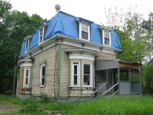
- Recently documented Jerome Street building in Medford. Digital photography has made documentation easier.

Photography – Having been around since the early 19th century, photography is a great tool to help us visualize locations. Historic images provide us with clues to how a building might have changed over time. They allow us to see how people dressed. They give us a window into the past which is as close as we can get, aside from actually living there. Since invention of film based cameras in the early 20th century, photography has stepped up its game. Thousands of individuals take pictures. Think of all the photos your parents or grandparents might have. Recently, the use of digital photography has exploded the photography field. I’m convinced that sooner or later, there will be a picture of every location in the world. Who knows how good this will be, but we can wonder that in the next century. Right now, I use photography to document real conditions. Its much easier to snap some photos of a building than have to draw out every last detail. Aided by a measuring stick for scale, photography can’t lie. You can’t miss details because of drawing error. The only down side is the potential for loss. Print those photos because in the digital world, information can be lost with the loss of the computer.

Laser tape measures are great for long distance shots.
Measuring Tech – How to measure a building has come a long way. I have seen a number of new products out on the market, but let’s start with the simplest. I originally used a measuring tape, which is the standard, no nonsense way to document real conditions. It’s slow though and sometimes requires two people. You also can very quickly loose whole inches if you round. About four years ago, I purchased a simple laser tape measuring. This device quickly became my best friend. Set to a 1/16″ accuracy, I almost never loose critical distance because of rounding. It also is a HUGE time saver! One person can now measure a substantial three story building in less than a day, as opposed to two or more days with the tape.
The two above methods are great for small buildings or medium sized structures, but what about a more substantial structure? Well for that, 3D laser scanning is a good option for the exterior. This method scans buildings and generates real points in software which then can be translated to real drawings. Although this software does not require labor intensive work scaling building elevations and the like, I have heard of horror stories of the final products being significantly off from the built conditions. Here is an example of a technology not yet proven. I wouldn’t discredit the software though, because everything has its kinks when it first comes out.

Early 20th century blueprints.
Drawings – Drawing has come a long way in the past century and a half. Their rise in professionalism coincides with the rise of architects. Beginning in the mid 19th century, architects were designers who laid ideas out for clients on paper. It’s all done by hand, and there was an art to it. Early architectural plans had character, and were often accented by watercolors or other decorative mediums. Following the turn to the twentieth century, drawings became construction details for contractors who were actually building structures. Drawings became technical and lost their artistic side. It was still all done by hand, until the advent of computer based software. Making an appearance in the late 80′s, CAD (Computer Aided Design) software has come a long way in its ability to match and exceed hand drawing capabilities. Programs like Revit come with built in budget and material estimators. They can power through schedules for windows and doors and even generate 3D models. What can’t these programs do?! Their limited only by the designer itself, and believe me when I say that there are more drafters who don’t care enough about their work to be bothered with using a program to its full potential. Maybe we’ll share some of our CAD secrets in a later post.
What’s next you ask? Well the article I mentioned in the beginning discussed how they were using ariel laser shots to read the landscape through trees. It produced an interesting result, which revealed what you might not have been able to see on the ground. Don’t take my word for it though, see it in action on National Geographic’s website by following this link: http://news.nationalgeographic.com/news/2014/01/140103-new-england-archaeology-lidar-science/
Wonder if it’s being used in more than one place? Check out these two links to see it in action elsewhere!
http://www.bbc.com/future/story/20120827-the-laser-archaeologists
http://www.bbc.co.uk/news/science-environment-12820302
With all these great ideas floating around, it makes me wonder who will invent the next best thing for preservation. Who knows, maybe this article has made you think about it. Will you be the inventor of that next best thing?